

Seoul Biennale of Architecture & Urbanism
Detroit: The Contested Urbanisms of Abandonment
Author
Maria Arquero de Alarcon, Martin, Murray, Olaia Chivite Amigo
Publication Date
2019
The Post Industrial City in the Cities Exhibition
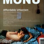
MONU #32 Affordable Urbanism
For The Right To Occupy And Hold Ground: Young Land Occupations And The Struggle For Urban Housing In São Paulo
Author
Ana Paula Pimentel Walker, María Arquero de Alarcón, Luciana Nicolau Ferrara, and Benedito Roberto Barbosa
Publication Date
2019

International Journal of Transportation
Overcoming the last-mile problem with transportation and land-use improvements: an agent-based approach
Author
Moira Zellner, Jonathan Massey, Yoram Shiftan, Jonathan Levine and Maria Arqueron de Alarcon
Publication Date
2016
Transit in the United States often suffers from the problem of inability to deliver travelers all the way from their point of origin to their destination. This “last-mile” problem is thought to deter transit use among riders with auto access, even when high quality transit service is provided for the majority of the trip distance. This study explores how transportation improvements, including automated driverless shuttles between origins of trips and nearby transit stations, and physical improvements enhancing pedestrians’ and cyclists’ commute might help overcome the last-mile problem particularly as they interact with policy shifts including changing in parking and fuel costs. To conduct this study, the authors developed an agent-based model representing the commuters and their preferences for different aspects of transportation disutility, namely cost, time and safety. Commuters in the model assess their transportation options in light of their preferences, the characteristics of their environment, and the various modes available to them. The model is calibrated with data from four Chicago neighborhoods, representing four different combinations of land-use patterns and household income. Simulations suggest significant potential for the combined shuttles and urban design improvements to shift downtown commuters to non-automotive modes (between 12 and 21 percentage point reduction in driving in three out of four neighborhoods). Less dense neighborhoods were more sensitive to higher parking costs, streetscape improvements and shuttle service than the denser and more pedestrian-oriented neighborhoods. Distance from the station encouraged driving, but the presence of shuttles encouraged shifts towards transit. Streetscape improvements tended to support transit use closer to train stations. In addition to anticipating a range of likely mode choice outcomes, the agent-based modeling approach facilitates exploration of the mechanism underlying travelers’ behavior. Rather than modeling through data fitting, this approach involved formulating theory of behavior first, using data to parameterize the conceptual model, and running simulations to see how the outputs would match observations. When discrepancies arose, the authors advanced the theory and reformulated the conceptual model to explain them. In this way, the authors found that a dense bus service shuttling travelers towards the commuter train station with express service downtown was critical in encouraging transit use, and extensive bus coverage throughout another neighborhood encouraged bus use to access downtown. Bike penalties representing various difficulties inherent to this mode (e.g., lack of physical fitness, the need for showering facilities at the destination, etc.) needed to be adjusted to higher values than those typically found in the literature, suggesting greater barriers to biking in this metropolitan area. Finally, the authors had hypothesized that pedestrian and biker presence would represent an important feedback promoting shifts away from driving, but this was not the case. Further in-depth empirical research is needed to improve the conceptual models of this feedback, and to understand how policy can leverage it to encourage greater transit, pedestrian and bicycle use.
Resilient Great Lakes Coast
Planning for Resilient Great Lakes Coastal Communities
Author
María Arquero de Alarcón and Jen Maigret (Visualization chapter), with Richard K. Norton (PI) University of Michigan, Guy A. Meadows (Co-PI), Great Lakes Research Center – Michigan Technological University, Harry Burkholder (Co-PI), Executive Director – Land Information Access Association (LIAA), Lan Deng, Larissa Larsen, Paul Webb, Stephen Buckman (Post-Doc) and Zachary Rable (Research Associate) at the University of Michigan; Claire Karner and Katie Sieb, Land Information Access Association (LIAA).
Publication Date
2015

Mapping Detroit: Land, Community and Shaping a City
Mapping Delray Understanding Changes in a Southwest Detroit Community
Author
Maria Arquero de Alarcon & Larissa Larsen
Publication Date
2015
Although the North American economy is considered post-industrial in character, pockets of heavy industry remain. Located at the confluence of the Detroit River and River Rouge, southwest Detroit is an amalgam of residential housing, ongoing industrial activity, and expanding transportation infrastructure. Some of the most deteriorated pockets of residential housing exist within the neighborhood of Delray. Historical accounts of this neighborhood in the early 1900s provide a glimpse of an active, mixed-use Hungarian enclave whose residents were attracted by the employment opportunities of the nearby industrial manufacturing facilities. Gone is the promise once present for neighborhood residents of economic advancement through industrial labor, and much economic activity has left. However, a proposal to locate the American side of a second international bridge in Delray returned public attention to this area. This urban landscape is a striking example of how global economic advancements can occur simultaneously amidst local decline.
Journal of Planning Education and Research
The Competing Social and Environmental Functions of Private Urban Land
Author
Ana Paula Pimentel Walker, María Arquero de Alarcón, Maria Fernanda Penha Machado, Juliana Lemes Avanci
Publication Date
2020
This article examines claims about the judicialization of the planning process. How does the judiciary manage disputes between constitutional rights to housing and a healthy environment in São Paulo’s informal settlements? We scrutinize thirty-six legal cases from 2013 to 2016 in the State Court of Appeals, examining the litigants and their argumentations. The findings demonstrate judicial deference to planning. Court rulings defer to municipal plans by invoking separation of powers and budgetary constraints principles. The supremacy of the plan highlights the ethical responsibilities of educators and practitioners and has implications for housing and environmental activists in their organizing strategies.

Journal of Applied Geography
Tracing shoreline flooding: Using visualization approaches to inform resilience planning for small Great Lakes communities
Author
Maria Arquero de Alarcon, Jen Maigret, Stephen Buckman
Publication Date
2019
Planning for increasing flood occurrences due to climate variability is posing new challenges to traditional master planning approaches in small Great Lakes communities. This paper calls for the incorporation of a wider range of visualization techniques as a critical component of local planning efforts to improve shoreline resiliency in the face of climate uncertainty. We utilized multiple visualization techniques to examine and illustrate diverse data sources as part of a community-based scenario planning process for three Lake Michigan coastal communities—Ludington, Grand Haven, and St Joseph, Michigan, USA—between 2013 and 2015. The outcomes demonstrate the localized impacts of climate variability on Lake Michigan’s eastern shoreland dynamics over time and visualize a range of future scenarios impacting inland land use. The results show that utilizing a range of visualization techniques in public engagement platforms offers communities a more detailed and complete understanding of climate variability, shoreland dynamics, and the trade-offs involved in community-based resilience planning. To support ongoing efforts advancing resilience planning in the State, many of the visualizations and a toolkit for the Michigan Association of Planners which provides a step-by-step guide for community-based master planning.

PLOT 08
El Espacio Público de Grano Fino en la Regeneración Urbana
Author
María Arquero de Alarcón
Publication Date
2012
María Arquero de Alarcón escribe sobre la propuesta de Somatic Collaborative (Felipe Correa y Anthony Acciavatti) para el Concurso de Anteproyectos de Teatro y Plaza de la República en el Distrito de Alameda en Quito.

Green Building & Design.
Guest Editors María Arquero de Alarcón & Jen Maigret
Author
María Arquero de Alarcón, Jen Maigret
Publication Date
2015
MAde Studio is not your ordinary architecture practice, if there even is such a thing. Founded by a Spain-born urbanist and a former biologist, the Michigan-based interdisciplinary studio has made waves recently by adding a layer of water to the way planners and politicians have been attempting to solve the crises of post-industrial Rust Belt cities like Detroit. Principals María Arquero de Alarcón and Jen Maigret met in 2009 at the University of Michigan’sTaubman College of Architecture and Urban Planning, both arriving in time for the fall semester. MAde Studio was born less than twelve months later.
The studio’s calling card is the rich use of data to foster imagination about public space in communities plagued by blight and disinvestment, an ambition present in projects like Playful Horizons and Liquid Planning Detroit. When we asked Jen and María to help guide our Ideas Issue, they turned us onto Liz Ogbu, selected our Editor’s Picks, and gamely participated in a wild search for the “next big idea in urban design”. In our conversation, we discuss everything from memory to imagination to “checklist” sustainability.
Research Report
Effects of Automated Transit, Pedestrian, and Bicycling Facilities on Urban Travel Patterns
Author
J. Levine, M. Zellner, Y. Shiftan, M. Arquero de Alarcon, A. Diffenderfer
Publication Date
September 2013
Transit in the United States often suffers from the problem of inability to deliver travelers all the way from their point of origin to their destination. This “last-mile” problem is thought to deter transit use among riders with auto access, even when high-quality
transit service is provided for the majority of the trip distance. This study explores how transportation improvements, including
automated driverless community transit between origins of trips and nearby transit stations, and urban-design improvements
enhancing pedestrians’ and cyclists’ commute might help overcome the last-mile problem. This study was based on four neighborhoods in metropolitan Chicago, selected as an area with significant regional rail but also room to grow in terms of transit use. The neighborhoods were chosen to represent similar access to the Chicago Transportation Authority (CTA) rail system but different combinations of affluence and density: higher-income/higher-density (Evanston); higher-income/lower-density (Skokie); lower-income/higher-density (Pilsen) and lower-income/lower-density (Cicero).
Overall, the presence of the community transit and urban-design improvements had a marked effect on the sample modeled. The sample lived within 1.5 miles of a CTA rail station and worked within 3 miles of a station. The transportation mode choices of this group were modeled with and without community transit and a set of urban amenities. Deploying these reduced driving by between 7 and 29 percentage points; the largest percentage-point reductions were in the more auto-oriented areas of Cicero (16 percentage points) and Skokie (29 percentage points). Auto-use reductions were somewhat lower in areas with greater transit use to begin with: Pilsen (8 percentage points) and Evanston (7 percentage points). Use of the train increased between 9 and 28 percentage
points, with more auto-oriented Skokie (28 percentage points) and Cicero (23 percentage points) exceeding the denser Pilsen (12 percentage points) and Evanston (9 percentage points). CTA mode shares among the sampled/modeled population increased from 24% to 52% in Skokie, 46% to 55% in Evanston, 52%to 75% in Cicero, and 52% to 64% in Pilsen. Across all neighborhoods community transit is forecast to decrease car share from its current 36% to 22% and increase CTA share from its current 50% to 67%. The findings that community transit produced greater change in the lower density areas of Skokie and Cicero are among the more robust in the study. Results from the stated-preference experiments suggest that these changes could be further improved with supportive augmenting policies, notably pertaining to parking pricing

Journal of Architectural Education
Imag(e)ing the Urban Water Commons
Author
Maria Arquero de Alarcon
Publication Date
2020
The necessity and desire to control water, a vital resource for life, have generated deep, irreversible territorial transformations. Resting on the banks of the Sabarmati River, the Indian city of Ahmedabad has long celebrated water as a driver of urbanity and inclusive citizenship. This essay builds on the many natures of the urban water commons and examines the ever-changing relationship of the river and its city as a productive breeding ground for architectural and urban design experimentation. The societal construction of alternative, collective water imaginaries starts by recognizing the many cultural, spiritual, and symbolic meanings around water, connecting us with an increasingly distant nature. It is this elusive condition of water that drives the studio pedagogy explored in this essay. The projects adopt different formats and disciplinary positions while reclaiming the designers’ cultural agency to advance socioenvironmental agendas and instigate political action.
Michigan Journal of Sustainability
The Competing Social and Environmental Functions of Private Urban Land
Author
María Arquero de Alarcón & Ana Paula Pimentel Walker
Publication Date
2018
This article examines the role of legal actors in mediating urban land conflicts involving informal settlements and the social and environmental functions of private property. This problem reveals the challenges of conciliating two constitutional rights—the right to adequate housing and the right to a healthy environment. Methods include an analysis of the urban policy and legal framework regulating environmental protection, housing provision, property rights, and land use law. The legal case analysis of Ocupação Anchieta, a young land occupation in São Paulo’s periphery, offers additional evidence through interviews with key informants, fieldwork including household surveys, participatory planning meetings, direct observation, and mapping of existing conditions. Findings demonstrate that private property rights continue to have uncontested power in the legal system, especially during the first years of an informal settlement. Furthermore, planning regulations do little to help young land occupations, vis-à-vis consolidated informal settlements, in establishing sustainable practices from the beginning. Peripheral urbanization through informal land occupations of environmentally protected areas remains one of the most pressing problems of the Global South. Thus, legal actors and planners should develop land use laws, urban policy, and mechanisms of private property conflict mediation that distinguish between young land occupations and consolidated informal settlements.
PLOT 21
Higienópolis: la Agenda de la Re-Invención Urbana
Author
María Arquero de Alarcón & Sol Camacho
Publication Date
2014
Sol Camacho Dávalos y María Arquero De Alarcón nos presentan un análisis histórico del barrio Higienópolis ubicado en la ciudad San Pablo donde exploran significados en su traza urbana y tradición modernista-paulista con respecto a la arquitectura doméstica en un contexto socio-cultural particular.

Journal of Transportation, Planning & Technology
The Impact of Automated Transit, Pedestrian, and Bicycling Facilities on Urban Patterns.
Author
Jonathan Levine, Moira Zellner, Maria Arqueron de Alarcon, Yoram Shiftan and Jonathan Massey
Publication Date
2018
This article reports on an integrated modeling exercise, conducted on behalf of the US Federal Highway Administration, on the potential for frequent automated transit shuttles (‘community transit’), in conjunction with improvements to the walking and cycling environment, to overcome the last-mile problem of regional rail transit and thereby divert travelers away from car use. A set of interlocking investigations was undertaken, including development of urban visualizations, distribution of a home-based survey supporting a stated-preference model of mode choice, development of an agent-based model, and alignment of the mode-choice and agent-based models. The investigations were designed to produce best-case estimates of the impact of community transit and ancillary improvements in reducing car use. The models in combination suggested significant potential to divert drivers, especially in areas that were relatively transit-poor to begin with.
Michigan Journal of Sustainability
Liquid Planning: Water as a Lens Toward Sustainability
Author
María Arquero de Alarcón, Jen Maigret.
Publication Date
Fall 2013
The development of collaborative, cross-disciplinary, pedagogical frameworks is an institutional priority at the University of Michigan that promises innovative advances in research at the intersection of ecological and urban dynamics. The Taubman College of Architecture and Urban Planning is well poised to foster models of scholarship and teaching, particularly those that can contribute to a better understanding of the relationships between environmental processes and the design of our built environment. Initiated in Fall 2011, Liquid Planning, a three-credit advanced graduate seminar course, enrolls students from architecture, environmental planning and policy, landscape architecture, sustainable systems, urban design, and urban planning to bring a wide range of expertise to the classroom around a shared urban challenge involving urban stormwater management.
Liquid Planning is a collaborative teaching initiative that develops methods of trans-disciplinary practice. In particular, the courseexplores approaches to sustainable design and revitalization through an investigation into the common mis-registration between urban infrastructure and natural water systems. Because water is a critical component in an understanding of past and present conditions and future paradigms for metropolitan regions, Liquid Planning utilizes watershed thinking to foster approaches that bridge scales, work within temporally dynamic systems, and establish processes that transcend established administrative boundaries. In these ways, Liquid Planning recognizes the importance of design disciplines in the innovation of more sustainable construction practices.

ACSA Collaborative Practice
Young, Informal and Sustainable
Author
Ana Paula Pimentel Walker, María Arquero de Alarcón
Publication Date
2019
Michigan Journal of Sustainability
Visualizing the Dynamic Shorelands of the Great Lakes
Author
Maria Arquero de Alarcon, Jen Maigret, Susan Landfried and Bin Zhang
Publication Date
2016
The shorelands of the Great Lakes are dynamic systems that shape the culture, economy, and ecology of the region. The 3,200+ miles of Michigan shorelands support one-third of the state’s cities and border four Great Lakes. This territory provides a rich inventory of waterfront conditions that will experience exacerbated conditions of change as future climate conditions amplify current fluctuations. This littoral zone is always in flux. Lake water levels register seasonal to decadal temporal oscillations and are amplified by strong and tall waves. These interactions pose acute challenges to lakeshore communities when negotiating between the necessity for setback regulations and their desire for access and proximity to the water. Given this context, sustainable planning efforts for shorelands must strategically accommodate dynamic fluctuations balanced with efforts for protection, enjoyment, and development.
This article displays a series of visualization techniques depicting shoreland dynamics along Lake Michigan, as part of a research collaboration funded by the Graham Sustainability Institute’s Water Center at the University of Michigan. The initiative draws upon expertise in coastal hydrodynamics, land use and environmental planning, fiscal analysis, vulnerability assessment, and visualization, and it partners with Land Information Access Association (LIAA), a Michigan nonprofit that assists communities in developing resilience planning strategies. As a collaborative research tool, visualization provides a platform for synthesis and enables more engaged and enlightened conversations with local communities, stakeholders, and decision-makers.
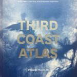
Third Coast Atlas
Inhabiting the Water Cycle
Author
María Arquero de Alarcón and Jen Maigret
Publication Date
2017
When illustrated for children’s textbooks, the water cycle is depicted in a state of perpetual motion. Big blue arrows demonstrate the various states of water as it circulates between the sky and two pristine conditions of land and ocean. In the official US Geological Survey (USGS) illustration, precipitation flows down the glacial peaks of a volcanic mountain range into a turquoise-blue ocean while simultaneously infiltrating and recharging the groundwater storage aquifer. In example after example, the representation of water cycle processes are both conceptualized and recapitulated within abstractions of “nature,” devoid of the ubiquitous ground conditions that manifest in constructed places of inhabitation. It should therefore come as no surprise that the water infrastructures within urbanized areas have been largely rendered as autonomous systems designed to efficaciously remove the nuisance of water (specifically wastewater) from our daily experience.
Despite the tremendous amount of effort that has been devoted to making precipitation invisible once it hits the ground, the visual and physical experience of dynamic weather systems are an important reminder that we are, in fact, active inhabitants of the water cycle. This perceptual schism between water, earth, and air is a representational and design challenge even within the region most abundant with fresh water in the world—the Great Lakes Basin. On the ground, a century of engineering paradigms, propelled by the headlong pragmatism of wastewater-treatment industry, have led to infrastructural failures occurring at astounding intensities. Skyward, thunderstorms commonly reach a surprising level of strength with an unpredictable frequency, making these dynamic systems elusive to static quantifications.
Architect’s Magazine
MAde Studio is Liquid Planning Detroit
Author
María Arquero de Alarcón, Jen Maigret.
Publication Date
2014
Detroit, America’s poster child for the post-industrial shrinking city, may suffer from a paucity of residents and resources, but it’s a boomtown of urban theory. There is no shortage of clever schemes aimed at repopulating vacant houses and vacant land. Jen Maigret, AIA, and María Arquero de Alarcón, co-founders of Ann Arbor, Mich.–based MAde Studio, have a slightly different perspective: What if you look at Detroit not in isolation, but as a regional system defined by its watershed? How would that change planning? “We are interested in different scales,” Arquero says. “And we are not interested in only focusing on the metropolitan area.”

UHF05 E.R.R.A [Error, Ruido, Riesgo, Accidente]
Landscape Matrix
Author
María Arquero de Alarcón & Emilio Ontiveros de la Fuente.
Publication Date
2008
The UHF group sprung up as a forum for dissemination and researching strictly contemporary subjects, to open up a channel for retroactive communication between the publication and its surroundings.
Our way of coming to grips with the different themes has always started on a-hierarchical, counter-architectural approach, with much interest in the output of Schools (especially in end-of-course design projects, thesis and competitions) and professional designs that often fail to get very far off the drawing board. We found our niche on the peripheries of other publications, trying to publicise both more experimental work and the “dirty” architecture produced for market consumption. In both extremes, we try to see attitudes and strategies that, when superimposed, enable us to understand in their full complexity the new modes of this discipline.
Catalunya Continental, Rail Infrastructure as the backbone for development.
Contribution: Matrix as a Tactical Methodology
Author
María Arquero de Alarcón, Sol Camacho
Publication Date
2007
It is generally accepted that there is a strong association of macroeconomic and political decisions with large-scale infrastructures. It is equally true that the territorial and urbanistic conditions in which new urban phenomena develop call for a greater rationality that draws together different scales to produce more efficient, integrative action.
This is the case of adequate assessment of the impact of large infrastructures on the landscape and particularly their effect on activities and the existing geography. We also have to understand, however, that in some situations networks and systems may produce a different definition to infrastructures, which are often excessively organized according to their hierarchical structure or internal logic, more typical of a top-down decision-making system.
We can therefore create paradigm models for the use and organization of a landscape whose backbone is formed by infrastructure which, in their capacity to enhance the territory, prove the advisability in social terms of implementing these infrastructures.
Belief in a series of urbanistic projects that integrate infrastructure and landscape, existing activity and new programmatic demands, prompted the proposal of the Studio as a kind of “research by design,” making it both a propositional and an evaluative mechanism. These were, at least, the initial intentions and the results are still open….